 Google is introducing more personalized maps that will recommend places to go based on their preferences and those of people with similar tastes.
Google is taking on a new challenge in mapping — creating real-time, personalized maps for everyone on the planet.
At its annual I/O developers conference on Wednesday, Google announced a new Google Maps, rebuilt from the ground up, by far the biggest redesign since it introduced Maps eight years ago.
When users who are logged in to Google visit Maps, they will see highlighted the places they frequently visit, like restaurants, museums and their home and office. Google learns the places they go by drawing information from all of Google’s services — including search and Maps history, Google Plus posts and information in their Gmail in-box. (A search on the new Maps revealed, for instance, that Larry Page, Google’s chief executive, likes State Bird Provisions, a restaurant in San Francisco.)
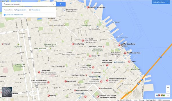
When users visit a new city, Google will recommend places to go based on their preferences and those of people with similar tastes.
The maps will change in real-time, so if you click on a museum, the other museums in the city will pop up. Choose a museum, and the map will shift so that the small roads and landmarks needed to navigate to that museum appear, and other street names fade away.
“Everybody gets their own map, every time,” said Jonah Jones, the lead designer for the new Google Maps, in an interview before the conference.
The new Google Maps looks different in other ways. The maps now fill more of the screen, including space on the top and sides. If you search for cafes nearby, for instance, results are labeled on the map (they are not in the old version) and cards with relevant information appear on the map. These can include ads, which are labeled in purple, and offers like a coupon for a local business.
Google Earth, which shows satellite 3-D imagery, was previously available only as an app to download. Now, it will be incorporated in the online version of Google Maps, so users can zoom in and explore a city’s landmarks in 3-D. They can zoom out and see the planet, with real-time weather, and the Milky Way.
While Google engineers were testing the maps in recent weeks, they noticed a black smudge on the Earth and the sun. At first, they thought it was a problem with the map, but then discovered that they were seeing an eclipse on the other side of the world, off Australia, in real time.
Google can do this because of a technology called WebGL that renders graphics inside a browser, as opposed to downloading images from a server, a process that takes longer and does not allow graphics to be as complex.
People can also view users’ photos from various places and see inside hundreds of thousands of local businesses. And the new Maps has improved public transit directions, including a schedule of departure times, a comparison with driving times and personalized directions from a user’s home.
Google plans to slowly introduce the new Maps to users, starting with conference attendees and then people who sign up online. It is only for desktop computers to start, but Google will also be updating its iPhone and Android Maps apps soon.
Article source: http://bits.blogs.nytimes.com/2013/05/15/major-redesign-of-google-maps-is-unveiled/?partner=rss&emc=rss
Speak Your Mind
You must be logged in to post a comment.